Department Details

Records Access Officer
Isaiah Thelwell
Rhode Germain
Administrative Assistants to the Planning Board and Conservation Commission
Conservation Agent
Kyle Holden
Planning the Future of Brockton
City-wide Comprehensive Plan
The Department of Planning and Economic Development has kicked off an eighteen month effort to develop a city-wide comprehensive plan with the goal of increasing the pride we have in our community and its assets and creating a framework for our City to thrive as a prosperous, livable, and inclusive community that is poised to capitalize on opportunities for growth and economic development.
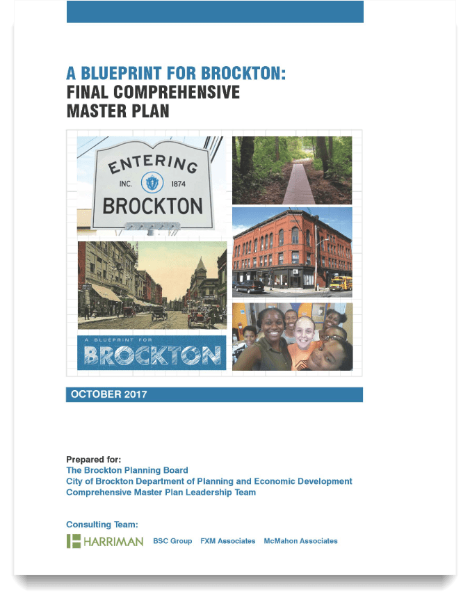 The last Comprehensive Plan was published in 1996. Since then, Brockton has undergone significant population and socio/economic changes. The new plan will incorporate those changes and better represent the goals and aspirations of our community.

Wayfinding
As you know, finding your way around Brockton is not easy, even for a lifetime resident. There are no east-west streets by that bisect the city and only one north-south road (Main Street) that does so. When traveling in the city, it’s not uncommon to back track, cut through parking lots or make four right turns to take a left. It’s for these reasons we are embarking on a new Wayfinding Plan for the city.
Wayfinding is just a fancy word for how we orientate ourselves to a physical space and travel from place to place. In other words, “I’m on Rte. 24, how do I get downtown (or any other location in the city).”
The plan below identifies different levels of signage, ranging from the greater city recognition “Welcome to Brockton” through the district identification, “Downtown Brockton” or “Campello” to the destination acknowledgement, “City Hall,” “Train Station,” “Library.” The plan also shows two different concepts on how these signs could look. These are only an example provided to illustrate the concept. When we advance the plan to the implementation stage we will work with a design team and a group of community stakeholders to actually choose the design.
Click here for a copy of the March 12, 2020 Wayfinding presentation
Click here for a copy of the final Wayfinding Plan
Campello Neighborhood Plan
The Campello Neighborhood Plan is a shared community vision for the future of the Campello station area and southern Main Street corridor. Through the planning process, funded with a grant from the Massachusetts Housing Partnership’s Complete Neighborhoods Initiative, we looked at the existing land uses, transportation patterns, demographics and economic factors that shape buying habits and real estate investment, green space and local amenities and community institutions.
A steering committee of local residents, property owners and businesses, called the Campello Partnership, assisted the City and its consultants to guide the planning process. As part of this process the City encouraged meaningful public participation by attending a series of community-based events across the city over the summer of 2023 and hosting a Pop-Up planning event in Campello on Saturday, September 23, 2023 at the Brockton Housing Authority’s parking lot located at 1090 Main Street.
What we heard, and what is represented in this Draft Plan, is that the Campello residents and businesses see the heart of the Campello neighborhood, from Neilson Street on the north to Keith Park on the south as being a traditional, moderate density, mixed-use and walkable “village.” Moving south along Main Street we see the existing residential neighborhood with supportive commercial uses transition to more auto-dependent uses around Sargent’s Way and employment generating commercial and light industrial uses further south, down to the City’s boarder with West Bridgewater.
A draft of the Plan Report and its two Appendices (A and B) are now available for review and comment linked below. Our next step will be to present the Final Draft to the Brockton Planning Board for adoption at their May 7, 2024 meeting, followed by its submission to the Brockton City Council for their consideration.
As a follow up to this work, the Department of Planning and Economic Development will propose new zoning to support the Plan and endeavor to create an Urban Renewal District to guide the implementation of the Plan.
Campello Neighborhood Plan Public Draft https://drive.google.com/file/d/1WwQmMs-37JwKlHePxJ6qFs3osdrdxjiJ/view?usp=sharing
Campello Neighborhood Plan Appendix A https://drive.google.com/file/d/1ob93vYXNccFirdHTCznGC1wGWaEDc9eS/view?usp=sharing
Campello Neighborhood Plan Appendix B https://drive.google.com/file/d/1DSCDv4wjdExQHThYd6tIABxI5nDUtcVR/view?usp=sharing
Lovett Brook (Good Sam Area) Master Plan
The Lovett Brook area is located at the intersection of Routes 24 and 27 in northwest Brockton. The site is anchored by the Good Samaritan Medical Center and includes the headquarters of Harbor One Bank and the Original Tommy Doyle’s Pub and Grill. Lovett Brook bisects the site, which contains a broad mix of office, retail, residential, and auto-oriented uses. Oak Street and North Pearl Street are lined with active businesses, although one is located directly over the brook. However, the interior of the site on the west side contains a single house, a small strip mall, and the concrete pad and parking lot of a former movie theater (closed in 1999, demolished in 2015).
MassDevelopment sponsored this planning process with a grant from its Site Readiness Program. The consultant team is Innes Associates with Tighe & Bond and RKG Associates; they are assisting the City of Brockton, the Brockton Redevelopment Authority, and MassDevelopment.
The first phase of this project is this land use plan for the underutilized area around the Good Samaritan Medical Center. The focus of this plan is to take advantage of the existing medical center with appropriate uses related to the life sciences sector and add other uses that are complementary to the existing neighborhood and provide amenities to attract employers and employees.
More information about the planning process and a copy of the draft plan can be fount at https://www.lovett-brook-brockton.com/
Campello
The City of Brockton is identifying reinvestment and development strategies to invigorate the local economy and revitalize community assets of the Campello Neighborhood.
Strategies include introducing new land-use types that increase density and diversity of use, amending existing zoning, and using development models like Transit-Oriented Development (TOD) to expand commercial and residential offering and improve transportation infrastructure for pedestrians.
This effort will focus on leveraging existing assets including transportation infrastructure like the Campello MBTA station, public parks and open spaces like Keith Park, and historically relevant features such as the Franklin building. It also identifies solutions for addressing contemporary challenges impacting the neighborhood like vacant storefronts and buildings to be put back into revenue service, empty lots where new residential and commercial uses could be established, and a combination of lack of open spaces and parks in poor maintenance. This document provides a review of existing conditions from previous studies, including market forces of the Campello neighborhood; summary of the public outreach process of both residents and business community; and recommendations for preferred development and land-use as identified by community members and stakeholders to encourage reinvestment in the Campello Neighborhood.
The Department of Planning and Economic Development is working with Old Colony Planning Council for developing a Campello Neighborhood Business District and Southern Main Street Visioning Plan.
The area for the Campello Neighborhood Business District and Southern Main Street Visioning Plan is located in and around the traditional Campello neighborhood in the southern end of Brockton.
Campello Study Area Charette Map
The Plan includes a review of existing conditions within the Plan area, a review of past studies that have focused on the area, multiple public participation events to obtain community input from local stakeholders, business owners, and city officials.
The Plan will result in a series of recommendations and implementation strategies that are designed to spur greater residential and economic activity within the area.
Thatcher Street Smart Growth Overlay District
The City is working with the Sisters of Jesus Crucified and the Archdiocese of Boston Planning Office for Urban Affairs on a proposed MGL Chapter 40R Smart Growth Overlay District at the Our Lady of Sorrows Convent on Thatcher Street.
MGL 40R is a zoning designation that would allows denser residential or mixed-use development near transit stations, in areas of concentrated development such as existing city and town centers, and in other highly suitable locations. An application is currently under review by the Massachusetts Department of Housing and Community Development (DHCD) before being submitted to the Brockton City Council for consideration.
Our Lady of Sorrows Convent/261 Thatcher Street Next Steps
Planning Office for Urban Affairs has submitted an application to the Planning Board to create a 175-unit multi-family residential development the Property in a manner that complies with the requirements of the Article XIX of the City of Brockton Zoning Ordinance for the Thatcher Street Smart Growth Overlay District and will create a sustainable, healthy, vibrant and diverse community.
The Development a diversity of unit types, spread across five buildings in a campus like setting around the existing Our Lady of Sorrows convent building which serves as the Development's identity and centerpiece. The Development will also include 185 parking spaces, landscaped open spaces for residents of the Development and, as noted below, accommodations for an internal bus stop.
The following documents have been sent to BETA for an independent third party review and to the members of the Technical Review Committee.
- 40R Application and Introduction
- Attachment 1 – Floor area and Unit Mix
Attachment 2 – Draft Affordable Housing Restrictions - Attachment 3 – Traffic Impact Analysis
- Attachment 4 – Lighting Information
- Attachment 5 Stormwater Analysis and Drainage Report
- Attachment 5 – Appendix A Soil Data
- Attachment 5 – Appendix B Drainage Area Maps
- Attachment 5 – Appendix C GSI Sizing Calculations
- Attachment 5 – Appendix D HydroCAD
- Attachment 5 – Appendix E TSS and Recharge
- Attachment 6 – Stormwater Management Maintenance Plan
Downtown Trout Brook (CSX Area) Master Plan
The former CSX rail yard lies at the heart of the Downtown Trout Brook planning study area. The area and the rail yard are bisected by Trout Brook. This study area is northeast of downtown and is generally located between the MBTA Commuter Rail Tracks on the west and Parker Street on the east. Portions extend north from Elliot Street towards Puffer Playground and south along Plymouth Street towards Snow Park.
This area has some industrial uses but is mostly vacant, and it separates the Downtown from existing residential neighborhoods. This site is not contributing to the economic health of the Downtown, nor is it an asset for the adjacent neighborhoods. However, in addition to being adjacent to the Downtown, much of the Study Area is within easy walking distance of Brockton Station (the commuter rail) and the Brockton Area Transit Centre (bus station).
The purpose of this study was to evaluate future development possibilities for the site by understanding existing conditions – physical, environmental, and economic – and scenario planning to examine, as a high level, different mixes of land uses, including industrial, commercial, and residential. Research on the current conditions and the preparation of maps and other analysis followed the guidelines of 760 CMR 12.00 (as revised in May 2018) as the City anticipated that this planning process might lead to the development of an urban renewal plan under Chapter 121B of the Massachusetts General Laws.
Preferred Development Option
Guided by a local steering group, and after analyzing different development scenarios, the City hosted a public meeting on March 13, 2019 to present our finding and take public input. As a result, we have settled on a preferred development option for the rail yards and the property surrounding it.
Multifamily development along Court Street provides residential units within easy walking distance of commuter rail and bus services. The demand for goods and services from the residents of these units will also help support further revitalization of the businesses along Main Street. Active ground floor uses, such as a café or small convenience store could support the needs of both residents and commuters.
Along the rail tracks, commercial flex will add additional space for businesses and jobs to support the overall economy of the City and the specific economy of the downtown by providing demand for food, goods, and services.
Trout Brook becomes a significant asset to this area. Removing invasive plants will help restore the function of the brook. To the west of Trout Brook, this plan identifies flood storage areas to help mitigate existing and anticipated flood conditions. The east side of the Book would become a shared pathway for pedestrians and bicyclists. This pathway would connect Puffer Playground to the north of the CSX site and Snow Park to the south of the site. This pathway becomes a significant amenity for several neighborhoods in the area.
To the east of the pathway, the preferred plan includes a local playground, connected to the multi-use path, a single-family development that knits the existing neighborhood together by extending streets now unconnected to each other. The additional connections will create more access to public transit by fostering a better pedestrian network.
Downtown Trout Brook (formerly CSX Area) Next Steps
As you can see we have changed the name of the planning area from “CSX” to “Downtown Trout Brook.” The new name provides a more descriptive name to the area while anchoring it to our work downtown. So, officially, the area is now called the Downtown Trout Brook Redevelopment District.
In July of 2020, the City of Brockton, working with the Brockton Redevelopment Authority, approved an Urban Renewal District based on the Trout Brook Master Plan. The Urban Renewal District was approved by the Commonwealth in February, 2021. A copy of the Approval can be found here.
Subsequent to the approval, the City received a grant from MassDevelopment to develop a strategy for site acquisition and control. In May, 2023, the Brockton Redevelopment Authority issued a Request for Interest and Qualifications (RFI/Q), looking for qualified development firms who would partner with the Authority to advance site acquisition and redevelopment activities on 44.76 acres of the 66 acres district. The Redevelopment Authority received four Statements of Qualifications, and identified two of those respondents as qualified and meeting the needs of the Authority. Those two firms have been invited to submit proposals to the Redevelopment Authority with a due date in mid-June, 2023.
A copy of the Request for Proposal can be found here.
Click here for the November 6, 2019 BRA board presentation
Click here for a copy of the Trout Brook Urban Renewal Relocation Plan.
Click here for Frequently Asked Questions
Click here for a copy of the Final Urban Renewal Plan as approved by City Council
Click here for a copy of the Urban Renewal Plan Appendix A - Parcel Inventory
Click here for a copy of the Urban Renewal Plan Appendix B – Municipal Approvals
Click here for a copy of the Urban Renewal Plan Appendix C – CSX Area Master Plan
Click here for a copy of the Urban Renewal Plan Appendix D – Environmental Notification Form
Former Christo's Site
State Senator Mike Brady and members of our Beacon Hill delegation filed legislation (S. 2352) to allow the Commonwealth to dispose of the 6.8 acre site. The Commonwealth determined that it was more cost effective to rehabilitate on-campus facilities than to build a new off –campus building to support Massasoit’s Allied Heath program which left the fate of the old Christo’s restaurant and Massasoit Conference center as a point of speculation. To start a community conversation about the future of the site, the City of Brockton’s Department of Planning and Economic Development engaged with the local chapter of the Urban Land Institute (https://boston.uli.org/) for a Technical Assistance Panel (TAP). A TAP is a one day exercise that brings real estate and land use planning professionals together to help the City understand the key issues related to a particular real estate/development question and brainstorm some potential solutions.
The TAP panelists toured the site and the surrounding neighborhood, interviewed local stakeholders and institutions, and presented their findings and recommendations to the local stakeholders over the course of a single day. The full report will be completed in January of 2020. The link below is a copy of the ULI TAP presentation.
Brockton TAP Powerpoint Presentation
While the TAP had identified two development scenarios, they are by no means the only opportunities the community should be considering. The Department of Planning and Economic Development will be hosting a community meeting in Spring of 2020 to receive additional community input in order to develop a vision for how the site could be redeveloped. We are working closely with the Commonwealth, Massasoit Community College, and the residential/ commercial neighbors to develop a strategy that works to benefit all Brockton stakeholders.
Fifth Ward Councilor Jeffrey Thompson hosted the first of several virtual community meetings on Tuesday, September 15, 2020 to continue the ongoing discussion on the redevelopment of the former Christo’s and Conference Center site.
In particular area residents and the public at large are being asked to react to five development scenarios are based on feedback from previous meetings in the ward and what we learned from the Urban Land Institute Technical Assistance Panel. We looked at different levels of development density as well as economically feasible end uses for the site. The illustrations are intended to stimulate a conversation that will guide us in rezoning the area so our vision can be implemented.
The city will be taking comments, questions and suggestions through the end of September via email at [email protected]. Be sure to put Christo’s in the subject line. In October, department staff will deliver a memo to Councilor Thompson and City Council summarizing the discussion and outlining next steps for consideration.
Click here for a copy of the September 15, 2020 presentation.
Click here to view the September 15, 2020 meeting video.
And click here for a list of Frequently Asked Questions
Other Planning Efforts
The Department has identified 11 areas outside of downtown that should have their own District Master Plans.
These include the Campello and Montello districts as well as Belmont and Pleasant Street Corridors and the east side commercial districts along Centre, Court and Quincy. Each of these districts has an important role to play in improving the lives and economic opportunities of our residents. As staff and funds become available, the Department will begin a community led planning effort.
